GPS surveying system
Quality improvement of project realization
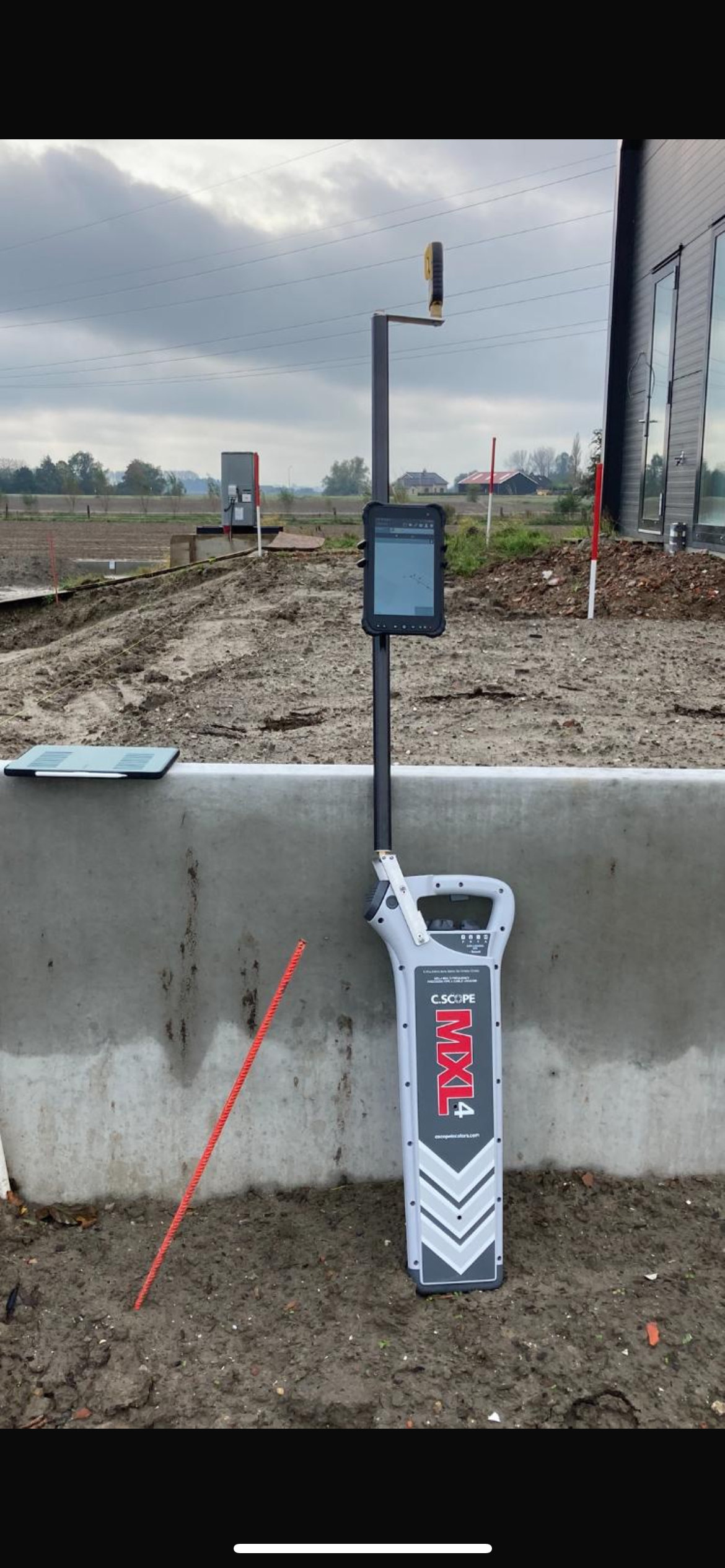
With this GPS system, you can realize every project exactly as your design. By surveying the above- and underground infrastructure in advance, you will not face any surprises. Improved work process: A GPS surveying system on the project is a sign of professionalism that improves the work process. The error margins on projects where a GPS system is used are much smaller than on other projects, especially when used in combination with a C.Scope cable detector. You can now even measure the depths of cables and pipes without digging.
Features
-Measuring visible objects
-Setting out designs
-User-friendly interface
-Measuring with centimeter accuracy
-Importing KLIC notifications
-Measuring underground cables
-Calculating quantities
-Exchange with CAD and GIS
Cost reduction
With this proprietary GPS system and easy-to-use software, there is no longer a need to hire expensive surveyors. Setting out is faster. And surveying is more accurate.
GPS measurement
Thanks to the software developed in the Netherlands, anyone can use this GPS surveying system.